Rainfall across the Nilgiri Biosphere Reserve
Rainfall Data from automated and manual rain gauges collected by Keystone Foundation with help of community volunteers.The rain gauge IDs used in the visualization below correspond to the following locations. RG001 -Kotagiri RG002 -Coonoor RG003 -Aracode RG004 -Sigur RG008 -Konvakarai RG009 -Pillur To download the raw data used in the above visualizations, check out this […]
Water Quality and Quantity Monitoring in Wells in Aracode Region
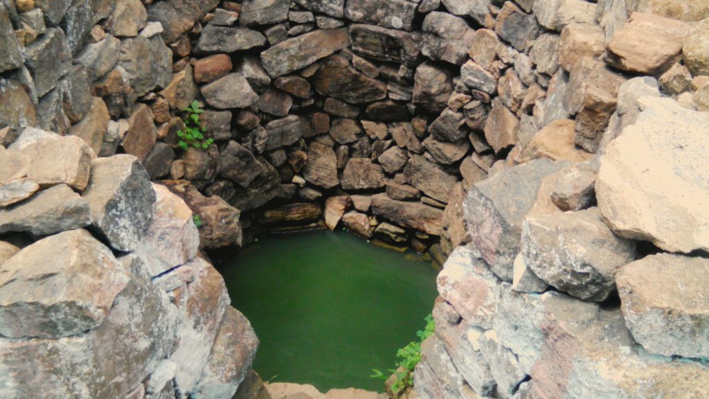
Aracode Aracode region is the Eastern most part of the Nilgiris which falls under the Kotagiri Taluk. There are Kurumba and Irula settlements in the dense forests where we carry out inventory and monitoring of wells with the help of community volunteers. Along with the quantity of water available in different seasons the quality of […]
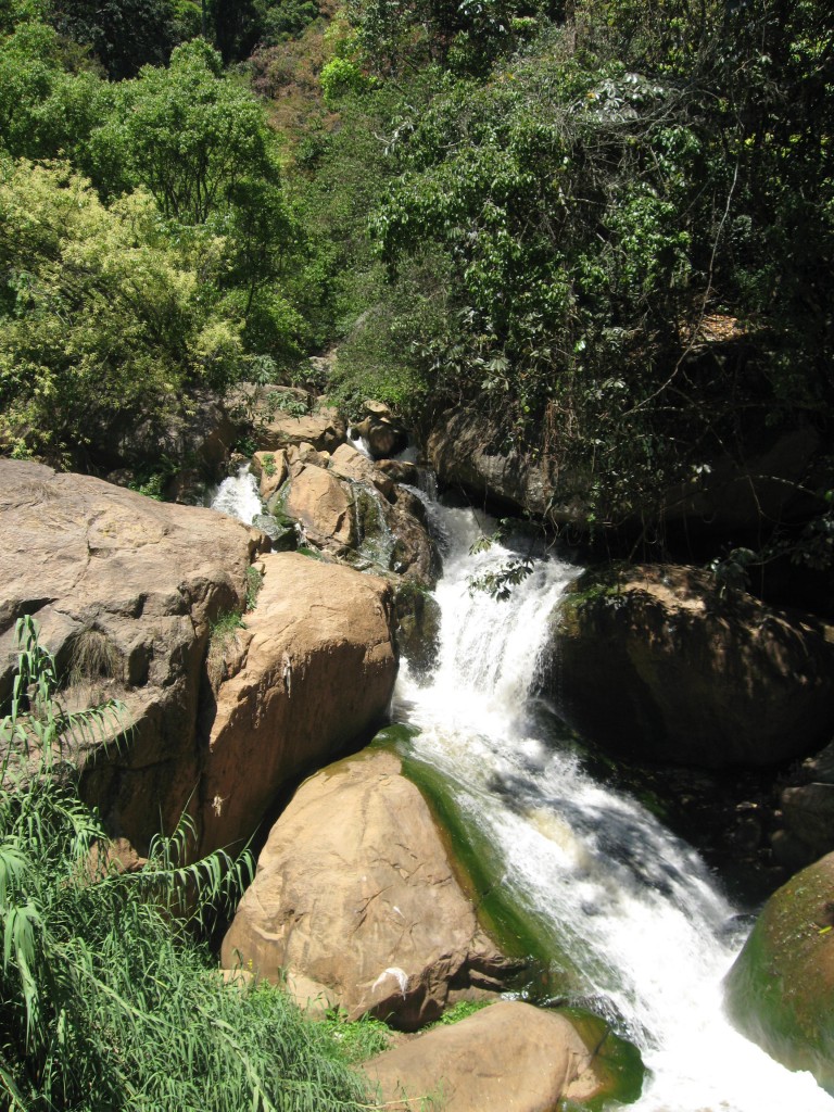
About Streams
The Nilgiris district can be divided into four basins. Moyar Basin and its 24 rivers – draining mainly into the Bhavani reservoir as water supply for irrigation and drinking water in Tamil Nadu. Bhavani Basin and its 26 rivers – draining again to the Bhavani reservoir along the district boundary and onwards again into the […]
Land Cover Change in the catchment of Ralliah Dam (2003-2016)
The Ralliah dam is one of the important sources of water for the Coonoor town. It was built in the 1930s. The catchment of the dam is mostly forest land dominated by exotics. There are wetland patches that serve to supply water to the dam throughout the year. Can you spot any changes in the […]
Land cover change in Elada Dam catchment (2008-2015)
The Elada dam is an important water source for Kotagiri town in the Nilgiris. It has become dry a couple of months back and this prompted us to revisit it and see what has changed, apart from the poor rainfall this year. One easy way to look at changes over time is to use historical […]
About Springs
Here’s a simplified understanding of Springs in the Nilgiris, particularly the upper areas. What are Springs? Springs are places in the soil or rock where groundwater emerges naturally. This could be a single point or a set of points close to each other. Springs that flow throughout the year are called perennial springs, whereas those […]
Map of springs inventory in the Coonoor region, The Nilgiris
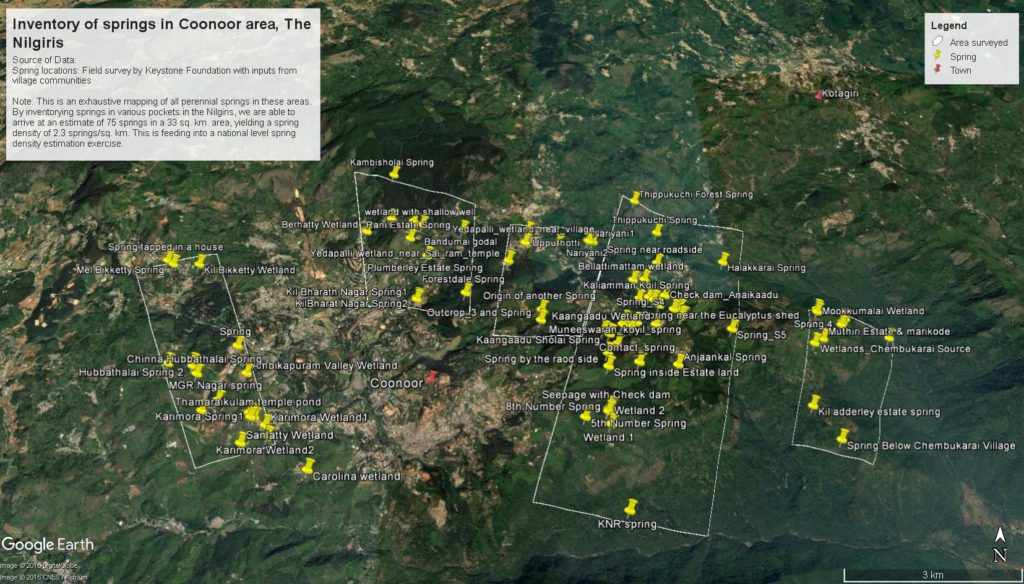
Over the last two years, Keystone has been mapping locations of perennial springs along with some baseline data. This is a first attempt of its kind in the Nilgiris as far as we know. Certainly no map or list of springs in this landscape is readily available to the public. Here’s a map of the […]
Springs and wetlands in the Nilgiris

The Nilgiris is the source of important rivers like the Bhavani, Moyar, Chaliyar and Kabini. These rivers in turn are the lifeline of the communities that live on and near their banks. This year the monsoon has played truant and subsequently there is much less flow of water in the streams and storage levels in […]
First Survey of Wetlands in the Nilgiris (2006)
Keystone conducted a baseline survey of 38 hill wetlands. We have mapped, inventorised flora, fauna and people dependence on wetlands. Wetlands have been classified in different categories as common property resources – in rural and urban areas and in private and protected areas. In each of these categories a threat assessment has been made and […]
About Wetlands
Wetlands of the Nilgiri region are unique, unlike wetlands in general – these are small sized hill wetlands, life giving in nature…habitat for a variety of wildlife, flora and meet the needs of the people. These wetlands are fragmented in small random patches – with underground connectivity of water channels. There are no dramatic landscapes […]
