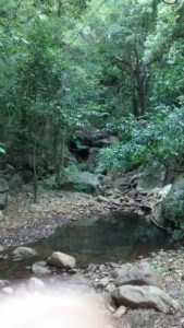
 The Nilgiris is the source of important rivers like the Bhavani, Moyar, Chaliyar and Kabini. These rivers in turn are the lifeline of the communities that live on and near their banks. This year the monsoon has played truant and subsequently there is much less flow of water in the streams and storage levels in Dams along these rivers are also low. If the monsoon is normal, then there is ample water flowing for the most part of the year. Ever wondered where the water flowing in the rivers and streams come from?
Just after a spell of rains, the run-off water from the catchments flow through these rivers and streams. However long after the rains are over, there is still a steady flow of water in many streams which ultimately contribute to the flow in the rivers. If we trace the origin of such streams we will end up in either springs or wetlands in the upper regions. It can be an astonishing sight to see water coming out of a hole in the ground or a crack in the rocks. One immediately wonders where this water is coming from. This invisible source of water below the ground is called an aquifer. These springs and wetlands are the places where the groundwater naturally emerges to the surface and becomes surface water.
Springs are a characteristic feature of the hills. These could be single points of water discharge or a series of discharge points located close together. This is determined by the kind of soil and rock structure in the area where the spring is located. Springs can be seasonal or perennial. In the Nilgiris, the sites of many of the older habitations were chosen due to the presence of springs there. There is a traditional belief that spring water is pure and uncontaminated by any pollutants. Sadly, there is no record of how many springs there are or how these are faring in these times of climate change. We need to record the locations of the springs in our neighbourhood and monitor them over time to understand their status and how we can protect them.
Most of the wetlands in the hills are often small, a few cents to a few acres in size. They have patches of land that are perennially wet and may also have standing water in some cases. They may or may not have inflows and/or outflows through channels or streams, depending on the topography. Wetlands play a crucial role in regulating the flow of water thereby ensuring year round water availability and reducing the chances of floods. Wetlands also clean the water of pollutants, provide a home to an astonishing variety of biodiversity and are an important source of drinking water to people as well as wildlife and livestock.
Small hill wetlands in the Nilgiris have been converted to other land use such as agriculture, tea plantations, built up area etc. Where groundwater table is going down, the wetland area is drying up and shrinking, and invasives such as Lantana are taking hold. Locally planted exotics such as Wattle also creep up on the wetland area. The increasing proliferation of open wells in the district, often in or near wetlands is also likely to lead to the drying up of wetlands. It is imperative that these wetlands are identified and monitored so that the changes taking place in and around them is understood and appropriate conservation measures undertaken.
Water is a need not only for people but also for wildlife and many incidents of Human Wildlife Conflicts are due to lack of water in the forests. Planning for water conservation needs to include human use, animal use and environmental flows. Ultimately, whatever be the source of water for a community – springs, wells or streams, the source for the year round flow is groundwater. Rainfall is the only source that we can use to replenish the groundwater we use. We need to not only protect our water sources, but also understand and conserve the catchments and aquifers in order to ensure the sustainability of water resources.

