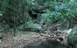
Land cover change in the catchment of Thalaikundah (2006 – 2016)
The Thalaikundah wetland is located next to a National Highway (Ooty-Mysore) and is subject to pressure from locals and tourists. The time slider lets us explore any changes in land cover in the last ten years.
Land Cover Change in the catchment of Ralliah Dam (2003-2016)
The Ralliah dam is one of the important sources of water for the Coonoor town. It was built in the 1930s. The catchment of the dam is mostly forest land dominated by exotics. There are wetland patches that serve to supply water to the dam throughout the year. Can you spot any changes in the land cover that are interesting?
Land cover change around Yedappalli wetland (2012-2016)
The wetland above Yedappalli village in Coonoor taluk is an important source of water. The water flows from here are tapped downstream by the Municipality to supply water to the town. Locally there are two temples near the wetland that are using the water directly from the wetland. By comparing the images from 2012 and 2016, the rapid changes taking place here can be easily seen. The land use change in the catchment will directly impact the health of the wetland.
Land cover change in Elada Dam catchment (2008-2015)
The Elada dam is an important water source for Kotagiri town in the Nilgiris. It has become dry a couple of months back and this prompted us to revisit it and see what has changed, apart from the poor rainfall this year. One easy way to look at changes over time is to use historical imagery from Google Earth. For ease of comparison the imagery from 2008 and 2015 for the Elada catchment has been converted into a time slider using javascript available at https://juxtapose.knightlab.com. If you note any significant changes in the catchment that you think may influence the

Springs and wetlands in the Nilgiris
The Nilgiris is the source of important rivers like the Bhavani, Moyar, Chaliyar and Kabini. These rivers in turn are the lifeline of the communities that live on and near their banks. This year the monsoon has played truant and subsequently there is much less flow of water in the streams and storage levels in Dams along these rivers are also low. If the monsoon is normal, then there is ample water flowing for the most part of the year. Ever wondered where the water flowing in the rivers and streams come from? Just after a spell of rains, the
Wetland Management Plans
Management Plan The first stage of the project was concerned with collection of data on wetlands from prominent wetlands of the Nilgiris. An attempt was made to cover as many wetlands as possible and from as many representative areas in the Nilgiris. However, the more we studied about wetlands; we realized that we have barely managed to touch the most outer surface of wetlands in the Nilgiris. For, not only were there innumerable wetlands, but each was distinct in its own way. We surveyed more than 40 wetlands and comprehensively covered about 38 of them. Along the way, we found

